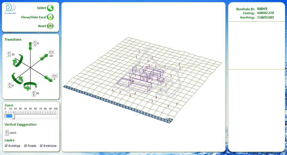
Taw Associates (TA) has developed a Visual basic Geographical Information System (GIS) package designed to run within Excel. With the cost of GIS software running into the thousands per license (or 'seat') the cost of performing in-house spatial information analysis, (ie what is where, and when) is often prohibitive. Knowing where your customers are, where a particular environmental anomaly is or simply who is where are queries that can now be run from within Excel with no additional software costs.
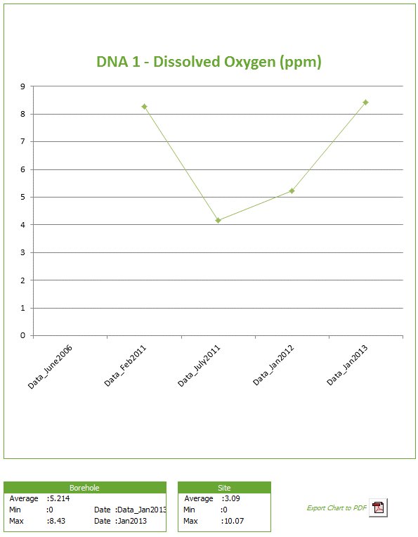
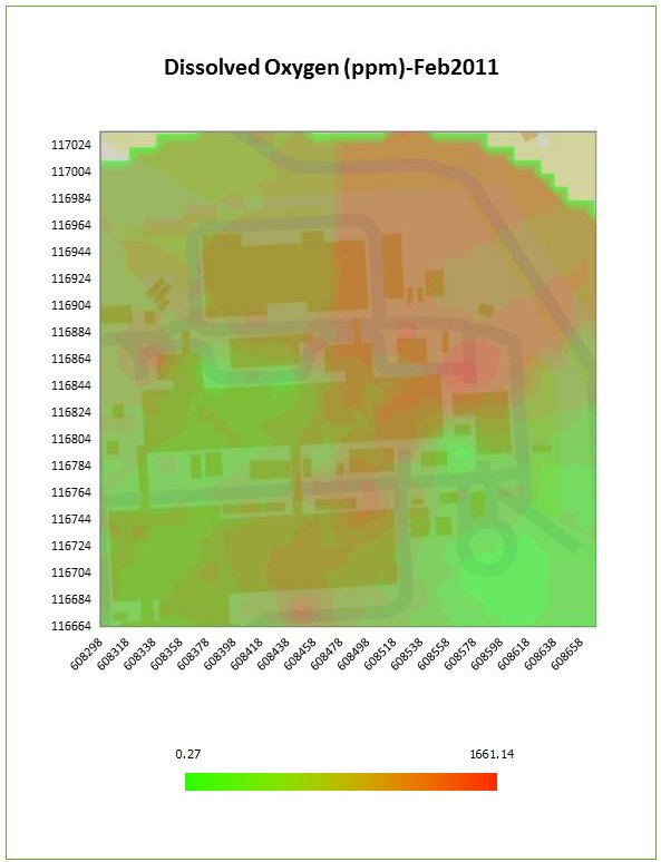
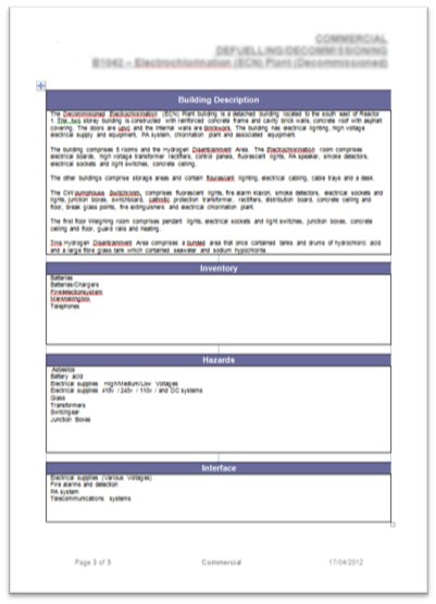
With pan, zoom, edit, measure and select functionalities, the system enables the user to store, interrogate and printout geo-referenced Excel data without ever leaving the Excel environment. Outputs can be tailored to individual reporting needs and can include PDF or native xml file formats including graphs, thematic or 'Heat Maps' and automatically populated word documentation.
