Understanding your environment
Surveillance, security, Mapping & Processing
Taw Associates thrive in operational and high-risk locations, delivering specialist data capture services including Aerial Surveillance & Reconnaissance. We bring expertise and experience together with technology, to create unrivalled results in the most demanding environments.
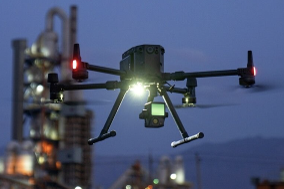
drone surveillance & reconnaisssance
Low altitude drone platforms offer a versatile, low cost, low risk method to gather covert, real-time intelligence, and reporting in any environment.

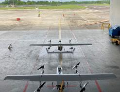
asset & pipeline security
Using a range of UAV’s, including fixed wing platforms fitted with cutting edge sensor technology can remove cost, and risk to personnel. Embedding into existing security plans, helps maintain operational efficiency, and regular overwatch on remote locations and linear assets.
environmental Mapping
Environmental mapping provides an unrivalled baseline record of environmental conditions. From assessing the condition of an eco-system as part of a baseline survey, or monitoring the spread of an invasive species, through to identification of specific minerals, UAVs provide a robust, defensible and transparent evidence based data-set.